The City of Compton has kicked off the environmental review period for a new specific plan for land use and development surrounding Metro's Artesia Station.

The station, located just north of the Artesia Freeway, is currently surrounded by warehouses and auto-oriented retail uses. The draft specific plan - created with the assistance of architecture firm SOM - envisions subdividing the large commercial tracts surrounding the transit hub, creating a collection of smaller blocks and sub-neighborhoods.

A full buildout of the specific plan could result in roughly one million square feet of new development, including:
- 4,803 housing units;
- 219,187 square feet of retail;
- 129,000 square feet of cultural facilities; and
- 217,073 square feet of office space.
New residential and commercial developments would be oriented around a series of landscaped paseos and neighborhood parks, distributed throughout the specific plan area.

Most buildings would range between three and six stories in height, with access to structured or surface parking. However, in key locations - mostly adjacent to park space - the specific plan would allow for buildings as tall as eight to ten stories.

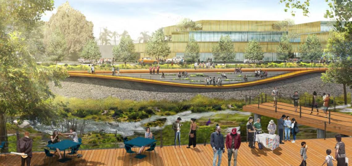
The specific plan also envisions a restored Compton Creek - highlighted by a proposal to remove a surface parking lot which currently caps a portion of the waterway. Stripping away the creek's concrete lid would allow it to be incorporated into a proposed central park for the station area.

The specific plan proposes parking requirements of:
- 0.5 spaces per residential units;
- 1 space per 1,000 square feet of office/cultural space; and
- 1 space per 500 square feet of retail.
Parking is intended to be located primarily in structures, though up to 10 percent of parking in the district would be allowed on city streets and 20 percent in surface lots.

The specific plan area - spanning approximately 760 acres - also considers future land use outside of the core TOD zone. Medium-density residential uses are proposed north of Century Boulevard and east of Alameda Street. Light industrial and technology uses - with limited opportunities for mixed-use development - are planned west of the TOD zone and south of the Artesia Freeway. The areas located east of Alameda Street are slated for future mixed-use functions as an expansion of the TOD core area.
Besides land use, the specific plan also touches on issues including public realm improvements and transportation. Items of note include a proposed bus plaza, to be located immediately west of Artesia Station, as well as concepts for complete streets improvements to major corridors cutting through the specific plan area.
The City of Compton is currently circulating the specific plan's environmental impact report for review. The comment period runs through December 9.