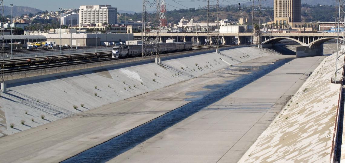
In 2015, legislation passed by California State Assembly Speaker Anthony Rendon initiated the Lower Los Angeles River Working Group. The group, which consists of community stakeholders and cities in Southeast L.A. County - as well as Tetra Tech and Perkins+Will - has now unveiled its draft revitalization plan for the 19-mile segment of the concrete waterway between Vernon and Downtown Long Beach.
The Lower Los Angeles River is currently flanked by legacy industrial uses and a number of working-class communities. Understanding that displacement is the most pressing concern for many residents in the surrounding area, the working group has identified a series of tools that could help curb gentrification in their neighborhoods. These include workforce development programs, support for locally-owned businesses, community benefits agreements, and - perhaps more controversially - rent control ordinances.
The working group, through the course of 82 community meetings, has identified 146 site-specific projects on properties directly fronting or in close proximity to the concrete-encased channel. But while the initial goal was to focus on river improvements, the plan goes further into establishing standards for streetscape and mobility improvements into the surrounding neighborhoods. This includes potential upgrades to up to 81 miles of existing streets and 22 bridges, as well as completing the currently fragmented paths that line both sides of the river. A story map offering a full list of the projects is available here: https://maps.tetratech.com/ab530/.
As part of the draft plan, seven projects have been singled out as case studies, and are spelled out in detail.
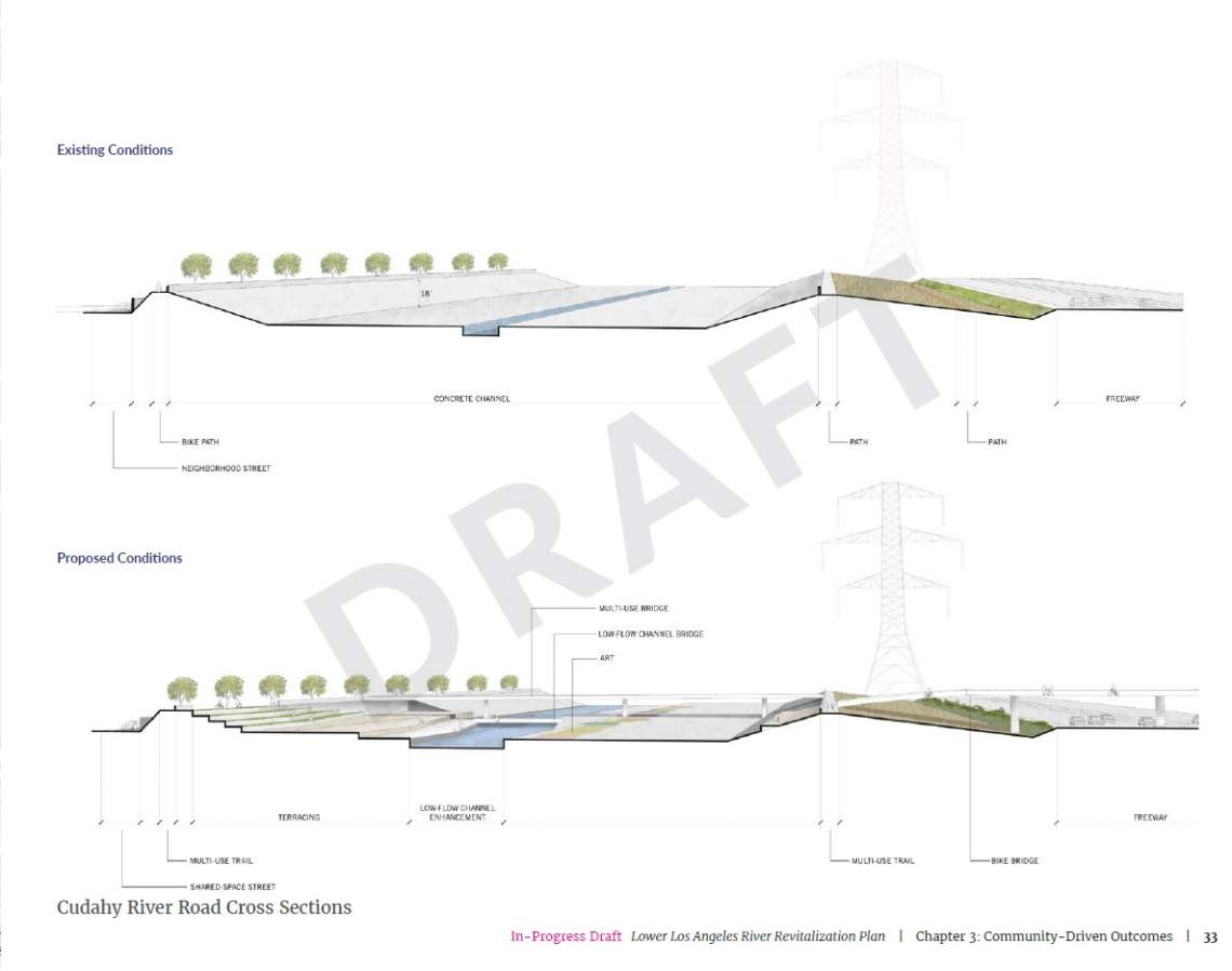
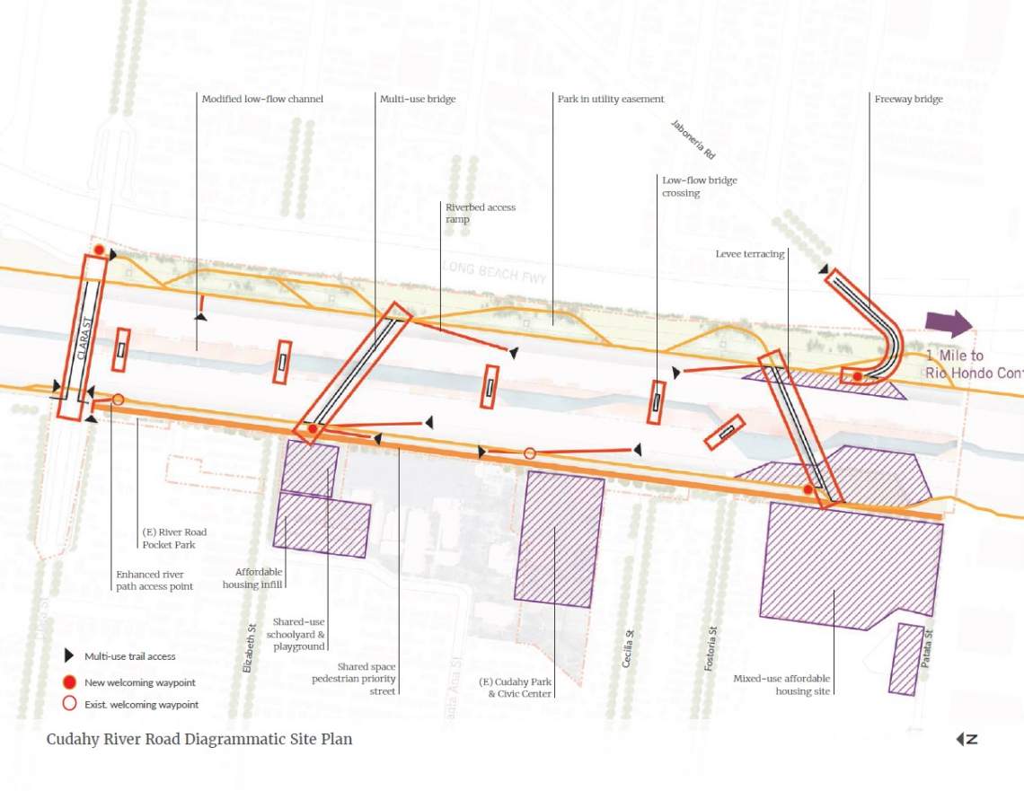
Cudahy River Park
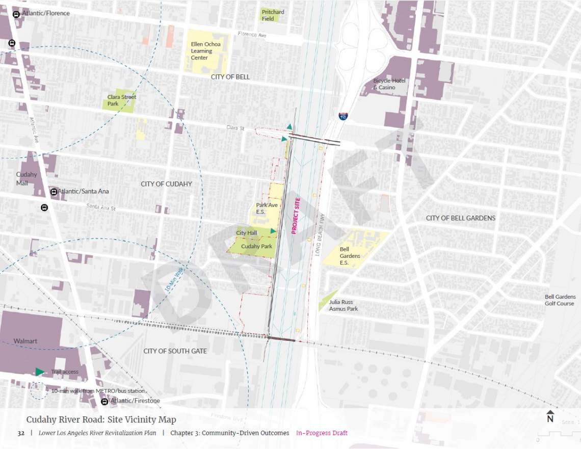
The project site runs between Clara Street in the north and a rail crossing at its southern end, flanked by low-density residential neighborhoods, public schools and several neighborhood parks. Although the L.A. River bike path runs along the west side of the river, there is no public access to the channel.
The draft plan envisions modifying the channel with multi-use bridges, access ramps, and levee terracing. Green space could be provided on the eastern bank of the river beneath existing utility lines, while public art could be installed along the concrete sections of the river bed. Connections to the surrounding community could be improved through a series of shared and complete streets.
The proposal also calls for stormwater management facilities and the potential for new developments - incorporating affordable housing - to rise alongside the park.

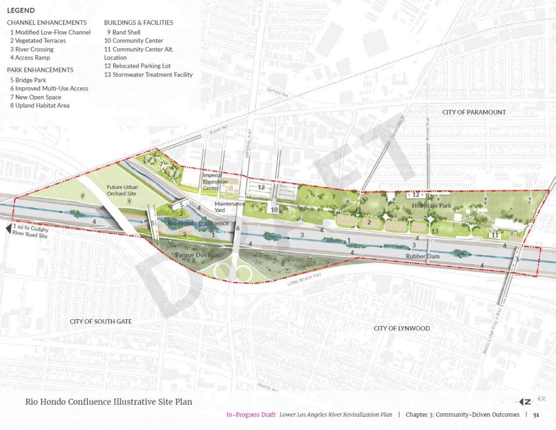
Rio Hondo Confluence
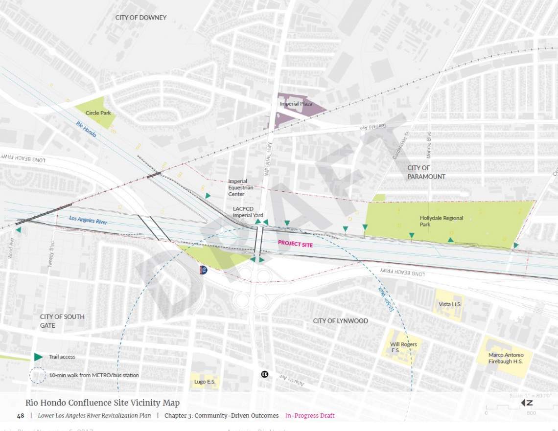
The confluence of the L.A. River and the Rio Hondo is viewed as one of the key opportunity sites along the Lower River. The project area - located near the cities of South Gate, Downey, Paramount and Lynwood - is largely isolated from surrounding neighborhoods by industrial properties.
The draft plan envisions modifications to the river channel, including vegetated terraces, access ramps, and a river crossing. Three bridge parks would cross the concrete channel, linking new and existing green spaces, as well as a proposed urban orchard and an equestrian center.

River South of Willow
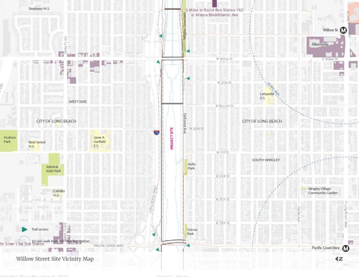
The 1.2-mile stretch of river to the south of Willow Road in Long Beach is flanked on both sides by low-density residential neighborhoods, with the popular bike path running along the east bank atop a levee.
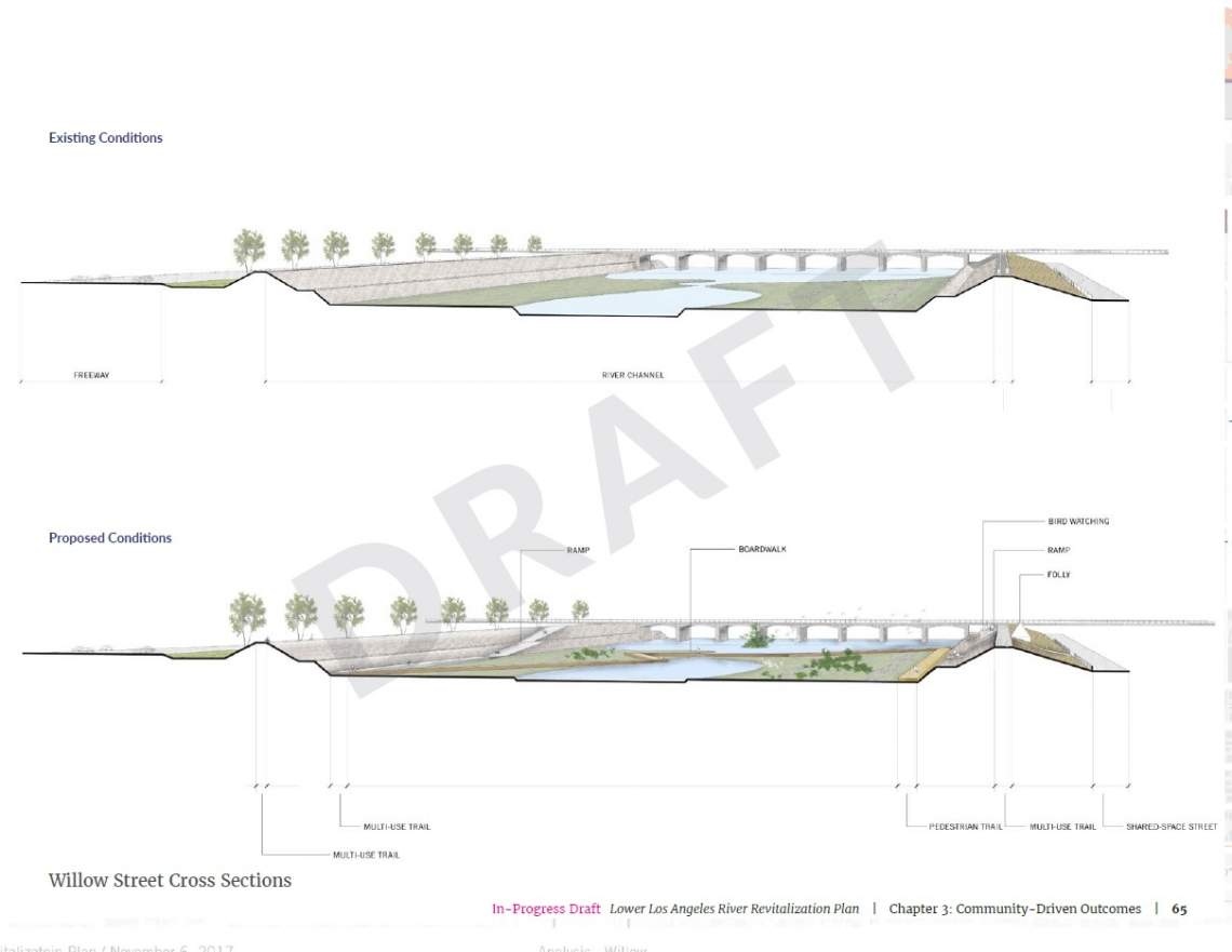
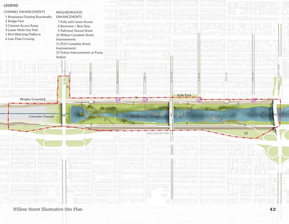
Due to its proximity to the river's outlet into San Pedro Bay, as well as its soft-bottom channel, this stretch is already one of the river's most natural appearing. Building off of this, the draft revitalization plan proposes the addition of bloating boardwalks, bridge parks, access ramps, multi-use paths and bird-watching platforms.
The surrounding community could also see improvements, including new complete street improvements and public facilities.
Upper Segment Easement

Located near Atlantic Avenue between the cities of Vernon and Cudahy, the proposed improvements at the upper segment include opportunities for kayaking, wetlands parks, multi-use trails, bridge parks, community gardens and even a rubber dam.
Middle Segment Easement

The middle segment, located south of the Artesia Freeway, could see new active recreation amenities, a learning garden, sports fields, a bridge park, and other riverfront observation areas under the draft plan.
Compton Creek Confluence
Potential improvements to the Compton Creek Confluence area would include new levee terracing, a community center, and other water recreation opportunities enabled by a rubber dam.
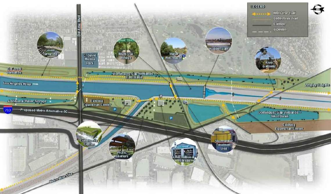
Wrigley Heights River Park

Located on either side of the 405 Freeway crossing - and flanked by the Metro Blue Line - the river park is envisioned with wetlands, bridge and overlook areas, active recreation facilities, a multi-use trail, a community center, stormwater treatment capabilities and other features.
Exact funding sources for these concepts have not been identified, the draft plan points to potential avenues at the local, state and federal levels.
The Lower L.A. River Revitalization Plan, when completed, will be adopted into the larger Los Angeles River Master Plan, which is being developed in coordination with L.A. County and L.A. City officials. An 11-mile stretch of the river between Downtown Los Angeles and Griffith Park is already poised for a more expansive $1-billion revitalization project, in conjunction with the Army Corps of Engineers. AECOM has also unveiled its Los Angeles River Gateway concept, which envisions a restoration for an additional four miles between the Elysian Hills and Downtown.
- Lower L.A. River (Official Website)
- L.A. River Archive (Urbanize LA)